Happy Boxing Day. As to your question start with Newton, then Copernicus, Galileo, Oersted and various other scientists that have determined the magnetic fields of all the planets, how they rotate around the sun etc.
Spot on. That's what i was trying to get him to see. Anyway, here is the article i was going to give him before he hit me with his 'you should learn science' snark.
"As evidenced from space the earth does not stand on it's head. How do we know which pole IS its head?"
LOL You deserve it. ;-)
Why maps point North on top? ByAnusuya Datta - 12/28/2020
Even though historically maps have pointed to other directions, why maps point North on top is largely because of the huge influence of European culture
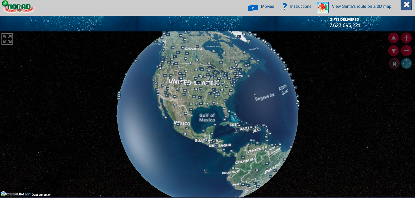
The official NORAD Santa Tracker page. Courtesy www.noradsanta.org
So even a pandemic couldn’t stop Santa Claus from coming to town. It sure was fun tracking the jolly good fellow on the NORAD tracker as he started his journey from top of the Earth, and hopped, skipped and jumped from one place to another, keeping his date with little kids. And oh, the International Space Station too. Now, the Christmas festivities are over, and the old man is back from where he started his journey – North Pole, or simply top of the world.
But have you ever wondered why North comes on top of a map and South below? When Earth is actually a sphere suspended in space, how come maps came to be standardized as North-up?
The North-on-top practice is actually a few hundred years old and coincides with the European imperialism, the long, across-the-seas explorations they undertook, and the practice of using the magnetic compass and Pole Star for navigation. “North was rarely put at the top for the simple fact that North is where darkness comes from. West is also very unlikely to be put at the top because West is where the sun disappears,” says Jerry Brotton, a map historian from Queen Mary University, London in his book A History of the World in Twelve Maps .. https://www.amazon.in/History-World-Twelve-Maps/dp/0141034939 .
So when exactly did it turn North side up?
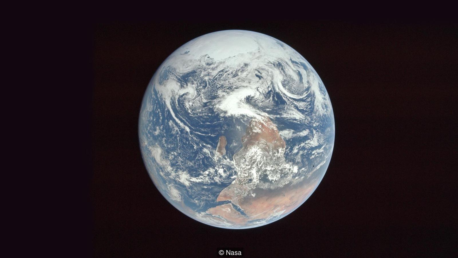
This famous Blue Marble photograph – Earth as seen by Apollo 17 in 1972 – in its original orientation was actually taken from space South on top. NASA decided to flip it before its publication to avoid confusion. (Courtesy: NASA/Wikipedia)
In fact, in ancient times the map was oriented to the sun, or to the East. A reason East is referred to as the “Orient”. In ancient India, maps were probably pointed to East. Though there is no physical evidence to support this, in Sanskrit “dakshina” means both “right” and “south”, thus indicating that maps in those times were East-oriented.
Ample evidences can be drawn from the Old Testament to say that East was at the top of maps in pre-Biblical and Biblical times. In Genesis, when Lot (Abraham’s nephew) is captured and is being carried away, Abraham and his men catch up with the captors and Lot is freed in “Chovah, which is to the left of Damascus.” Chovah lies in North of Damascus. Further, the Psalms 89:13 says: “The north and the right, You created them”. When South is on your right, you are facing East while reading the map. In medieval Europe too, Jerusalem was on top since that was the Holy Land, thus implying East was at the top.
Somewhere it took a South turn
Very early Egyptian maps show South on top. This could be because of the northwards flow of the Nile and since rivers were believed to be flowing “downwards”, they thought that “up” was South. However, Egyptian astronomer Ptolemy (90-168 AD) is known to have used a North-up approach.
The Chinese, who were the first to invent the compass, also often drew maps with South on top because they always thought the compass pointed to South. South was also their sacred direction (in any religious or royal ceremonies the kings faced south). This perception may have come because the northern parts of China were cold and dark.
Muhammad Al Idrissi’s map Tabula Rogeriana from 1154, upside down with north at the top. (Courtesy Wikipedia)
Even map makers in Arabia often drew maps with South on top. The Islamic maps favoured South since the initial Islamic habitations were north of Mecca, so a South-oriented map would show the followers looking up towards it. Another reason could be when we face the sun in the morning the South is on our right and because of our inherent bias for right side as being positive as opposed to the evil left, South was put on top.
[image here not coming for me] A reproduction of Jorge de Aguiar’s chart of the Mediterranean, Western Europe and African coasts, 1492. (Courtesy: Wikipedia)
Europeans learnt map-making from the Arabs and things started changing with the age of exploration somewhere in the Mediterranean regions — the link between Europe and Arabia. However, the 14th and 15th century navigational maps charting out sea routes — which were designed for the mariners — had no real top or bottom. They had pictures and words pointing at all directions with a compass rose with North clearly distinguished.
The world map by Henricus Martellus produced in 1490 was remarkably similar to the terrestrial globe later produced by Martin Behaim in 1492. (Courtesy: Wikipedia)
So would it be right to credit explorers like Columbus or Megellan for the North-side-up maps? Apparently no. Brotton believes when Columbus sets on his journey he believes he is going to paradise and hence in his worldview the East is on top.
It is actually somewhere in the 16th century with modern European imperialism at its peak and the great influence of their civilization across the world that made the map Europe-centric — and hence North on top. While the Chinese referred to their first magnetic compass as South-pointing, by the time Europeans came to adopt it, they were already experienced in navigating by referring to the North Star, the only fixed star in the Northern Hemisphere. For mariners the compass was just an artificial replacement for the star. And since Europe was situated in Northern Hemisphere, which anyway had more landmass to be explored, North-up maps became a standard.
Mercator’s 1569 map was a projection of the spherical Earth onto the plane. (Courtesy: Wikipedia)
Mercator’s world map in 1569 was a defining moment in North-up maps. In the history of cartography, it is regarded as heralding a new era in the evolution of navigation maps since it was the first to take into account the curvature of the Earth. However, even though Mercator had not laid any emphasis on North being on top, he probably did it simply because he was a European and Europeans were anyway doing most of the explorations at that time. The idea that North was on top stuck and has been so ever since.
No more Down Under
again image not coming, oh well, it upset someone to begin with Why maps point North on top? The Upside-down Map by Uruguayan painter Joaquín Torres García
South-up map as a political statement began in the 1940s. Uruguayan painter Joaquín Torres García was the first one to create an illustration called “The Upside-down Map” in 1943. When Garcia said “our North is the South,” it was a rallying cry to his fellow artists on the importance of South America.
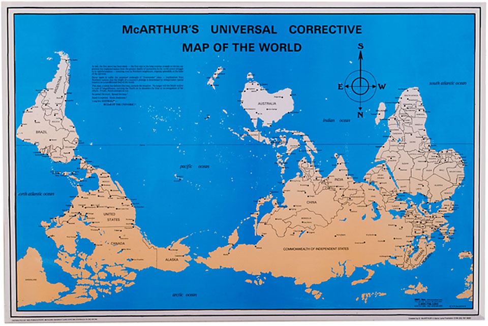
However, the most famous South-up map as a political statement is ‘McArthur’s Universal Corrective Map of the World’.
McArthur’s Universal Corrective Map of the Worldhas sold over 350,000 copies to date. (Courtesy: Wikipedia)
It is said McArthur, an Australian, drew his first South-Up map when he was 12, and was pulled up by his teacher who asked him to re-do his assignment “the correct way” if he wanted to pass. Three years later, he was taunted by a group of American students at an exchange program in Japan for “coming from the bottom of the world”. Six years later, in 1979, McArthur produced his famous South-up map as a student at Melbourne University. McArthur’s Universal Corrective Map of the World (1979) has sold over 350,000 copies to date.
In 1982, Jesse Levine published a south-up oriented map of the Americas, titled the ‘Turnabout Map’ or ‘A New World of Understanding Map’.
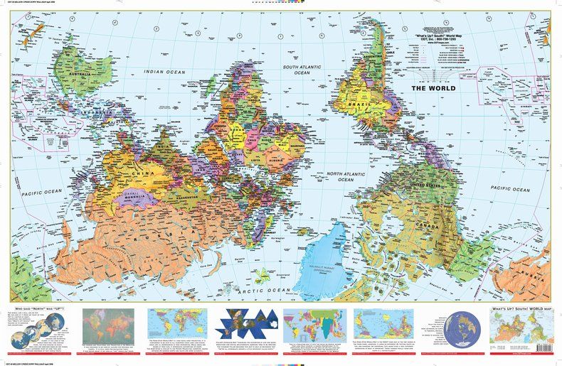
More revenge from Australia came with with the ‘What’s Up? South!’ map. The map, which has Antarctica on top of the world and Africa at the top center flanked by South America and Australia in bright colors and seven comparison panels on the bottom, challenges basic notions of “up” and “down”.
In Australia and New Zealand, ‘Upsidedown’ maps are becoming popular, especially with tourists, with slogans like “no longer down under”.
What’s special about a South-up map?
A look at a South-up map reveals a lot of things that we would miss a traditional North-up map. (Courtesy: ODT)
Studying a South-up or “reversed” map for the first time with familiar shapes of the world geography placed in a completely different way can be quite unsettling. But a careful look could reveal a lot of things that we would miss a traditional North-up map. For instance, South America is not exactly “south” of North America but is actually south-east of North America. Or the fact that Africa and the Middle East completely dwarf out Europe. Similarly, putting Canada or Russia away at the bottom of the map somewhat reduces their status. Russia at the bottom still appears huge but its size is definitely diminished by the larger Antarctica on top.
A South-up map still shows that the majority of the land mass is in the Northern Hemisphere. However, the interesting thing to note is how bottom-heavy a South-up map actually becomes with most of landmass bunched near the base. Another interesting thing to note is that the “southern” continents of South America, Africa, and Australia are not actually very “south”. They all lie entirely within the tropics with majority of Africa actually residing in the “Northern” Hemisphere.
Anusuya Datta A writer based out of Canada, Anusuya is the Editor (Technology & Innovation) focused on developments in North America. Earlier she has worked with Geospatial World as the Executive Editor. A published author on several international platforms, she has worked with some of the finest brands in Indian media. A writer by choice, an editor by profession, and a technology commentator by chance, Anusuya is passionate about news and numbers, but it is the intersection of technology and sustainability and humanitarian issues that excites her most.
 News
News  Market Data
  Discover