


Monday, December 28, 2015 10:44:55 PM
"An incredible variety of weather hazards made their presence felt over Christmas weekend across the central U.S., from blizzard to tornado to freezing rain to flash flooding and river floods. More than 40 weather-related deaths have been reported since Wednesday. The multi-day storminess is related to a gradual realignment of the large-scale pattern over North America. A stunningly warm, moist air mass across the eastern and southern U.S. - by some measures the most tropical on record for early winter - is in the process of being displaced by a strong upper-level storm across the West, bringing much more seasonable cold.
Deadly tornadoes struck near Dallas on Saturday - Ahead of a strong cold front in west Texas, supercell thunderstorms that ripped across the sprawling eastern part of the Dallas area spawned several tornadoes that killed 11 people.
The widespread persistence of warm, humid conditions over the last few days has led to a unprecedented U.S. stretch of severe weather for December, including tornadoes from Mississippi to Michigan on Wednesday. Sunday was the seventh day in a row with at least one U.S. tornado reported - the first such week-long stretch for any December in NOAA Storm Prediction Center records dating back to 1950. The previous record string of six days, December 22-27, 1982, occurred during the “super El Niño” of 1982-83.
2015 is the first year in records going back to 1875 that has seen more confirmed tornado-related deaths in December than in the rest of the year combined. The only other year with December having more deaths than any other single month was 1931.
Blizzard pummels southern High Plains As severe storms continued to rumble across east Texas on Sunday, the western part of the state was dealing with a crippling blizzard that extended into eastern New Mexico, while freezing rain knocked out power to tens of thousands of western Oklahomans. Exceptionally strong winds - gusting above 70 mph in some areas - have led to near-zero visibilities and drifts of 6 feet or more, paralyzing travel across the region.
Massive flooding hits Missouri and Illinois, killing 13 - Only days after major flooding across central and northern Alabama late last week, the weekend storm brought incredibly heavy rains to eastern Oklahoma, northwest Arkansas, and southwest Missouri, with 10.0" falling in a 30-hour period ending Sunday evening on the south side of Springfield, Missouri. An additional 1 - 2" of rain is expected over most of Missouri and Arkansas by Monday evening, but dry weather is mercifully expected the rest of the week.
Historic flood imminent on the Mississippi River - The Mississippi River near St. Louis was near flood stage late last week due to excessive rains of 2 - 4" (400 - 600% of average) that fell during the past two weeks farther upstream in Iowa, Wisconsin, and Minnesota. A massive pulse of flood waters from this weekend's epic December rains will pile into the Mississippi River over the next few days, bringing the river to flood levels never recorded this time of year. The Mississippi River at St. Louis was approaching moderate flood state on Sunday evening, and is forecast to crest on Wednesday at the second highest level ever observed, just five feet below the all-time record set during the disastrous flood of 1993.
On January 20, the Mississippi flood crest is expected to arrive in New Orleans, bringing the river to its 17-foot flood stage in the city, just 3 feet below the tops of the levees. The damage from the December 2015 - January 2016 Mississippi River flood is expected to run into the hundreds of millions of dollars.
The Big Christmas Warm - Hundreds of records were buried by sunshine, warmth, and humidity instead of white-Christmas snowfall all across the eastern U.S. during the holidays, especially on Thursday and Friday. Christmas Day was the apex for the north-south breadth of warmth, with record highs set from Florida (82°F in Jacksonville) to Maine (62°F in Portland). Many records on Thursday and Friday were smashed by margins of 10°F or more. Philadelphia has seen eight days this month (through Sunday) with record daily highs.
For the period 12/1 – 12/24, December saw a phenomenal 3164 daily record highs and 4511 record warm lows, compared to 147 record cold highs and 147 record lows. Despite the intense cold in the eastern U.S. early in 2015, this year will end up with more than twice as many U.S. daily record highs as lows."
http://www.globaldisasterwatch.blogspot.com/2015/12/monday-december-28-2015.html , http://www.wunderground.com/blog/JeffMasters/comment.html?entrynum=3212 [with comments]
and versus our old and now obliterated annual precipitation record of 53.54", looks like our new record is 62.61" (no further precip expected over the next three days) ([linked in] http://investorshub.advfn.com/boards/read_msg.aspx?message_id=117977925 and preceding and following, http://investorshub.advfn.com/boards/read_msg.aspx?message_id=118765879 and preceding and following, http://investorshub.advfn.com/boards/read_msg.aspx?message_id=118834291 and preceding and following):
[the current report at] http://forecast.weather.gov/product.php?site=fwd&product=CLI&issuedby=dfw455
CDUS44 KFWD 282226
CLIDFW
CLIMATE REPORT
NATIONAL WEATHER SERVICE FORT WORTH TX
425 PM CST MON DEC 28 2015
...................................
...THE DALLAS FORT WORTH CLIMATE SUMMARY FOR DECEMBER 28 2015...
VALID AS OF 0400 PM LOCAL TIME.
CLIMATE NORMAL PERIOD 1981 TO 2010
CLIMATE RECORD PERIOD 1898 TO 2015
WEATHER ITEM OBSERVED TIME RECORD YEAR NORMAL DEPARTURE LAST
VALUE (LST) VALUE VALUE FROM YEAR
NORMAL
..................................................................
TEMPERATURE (F)
TODAY
MAXIMUM 41 210 AM 81 1928 56 -15 49
1921
MINIMUM 36 1006 AM 11 1924 36 0 33
AVERAGE 39
PRECIPITATION (IN)
TODAY 0.54 0.91 1937 0.08 0.46 0.00
MONTH TO DATE 3.83 2.34 1.49 1.13
SINCE DEC 1 3.83 2.34 1.49 1.13
SINCE JAN 1 62.61 35.93 26.68 21.32
SNOWFALL (IN)
TODAY T 1.5 1915 0.0 0.0 0.0
MONTH TO DATE T 0.3 -0.3 0.0
SINCE DEC 1 T 0.3 -0.3 0.0
SINCE JUL 1 T 0.3 -0.3 T
SNOW DEPTH 0
..................................................................
WIND (MPH)
HIGHEST WIND SPEED 30 HIGHEST WIND DIRECTION N (360)
HIGHEST GUST SPEED 38 HIGHEST GUST DIRECTION N (10)
AVERAGE WIND SPEED 20.1
..........................................................
THE DALLAS FORT WORTH CLIMATE NORMALS FOR TOMORROW
NORMAL RECORD YEAR
MAXIMUM TEMPERATURE (F) 56 81 1923
MINIMUM TEMPERATURE (F) 36 10 1983
SUNRISE AND SUNSET
DECEMBER 28 2015......SUNRISE 730 AM CST SUNSET 530 PM CST
DECEMBER 29 2015......SUNRISE 730 AM CST SUNSET 530 PM CST
- INDICATES NEGATIVE NUMBERS.
R INDICATES RECORD WAS SET OR TIED.
MM INDICATES DATA IS MISSING.
T INDICATES TRACE AMOUNT.
$$
and our reservoirs:
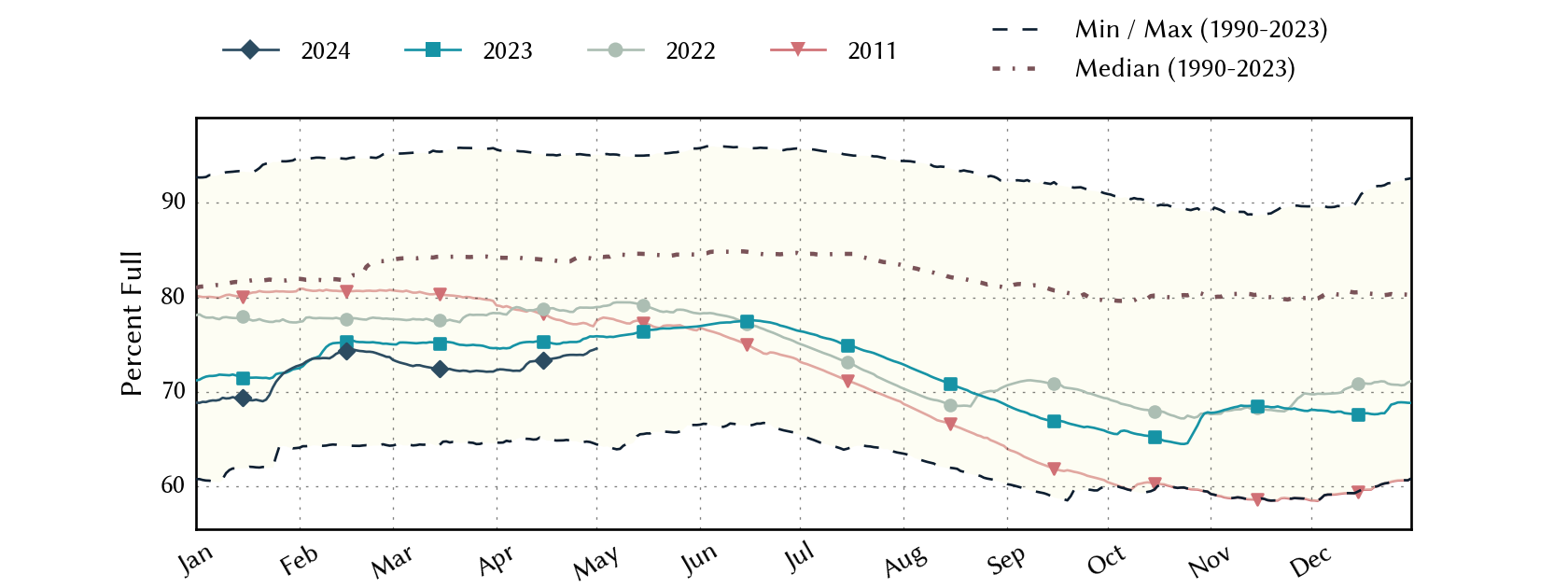
http://waterdatafortexas.org/reservoirs/statewide ['Statistics' view of the chart; will continue to update]

Greensburg, KS - 5/4/07
"Eternal vigilance is the price of Liberty."
from John Philpot Curran, Speech
upon the Right of Election, 1790
F6
Join the InvestorsHub Community
Register for free to join our community of investors and share your ideas. You will also get access to streaming quotes, interactive charts, trades, portfolio, live options flow and more tools.

