News
News  Market Data
  Discover
Support: 888-992-3836
Copyright © 2023 InvestorsHub Inc.


Register for free to join our community of investors and share your ideas. You will also get access to streaming quotes, interactive charts, trades, portfolio, live options flow and more tools.
i think its a boat wake.........but i am not sure.....
Your coordinates were fine.......look at my coordinates and tell me what that thing is....lol........z
its supposed to be the sydney opera house.......lol.......my coordinates were a lil off.....
What the hell is this? 33° 51.629'S, 151° 13.122'E
z
I think I can see 2 of them.........et z
UM FOOTBALL game w/blimp....... 42°15'56.99"N 83°44'55.50"W
i dont know if this will show up on your GE, but when they took this satelite pic, they got the goodyear blimp in there, too
sydney opera house.... 33°51'23.99"S 151°12'57.20"E
8 lost golf balls....arcadia bluffs 44°27'27.44"N 86°14'15.82"W
PALM...dubai.... 25° 7'49.27"N 55° 8'23.35"E
petronas towers..... 3° 9'27.16"N 101°42'41.54"E
machu picchu 13° 9'52.63"S 72°32'42.61"W
NAZCA lines...... 14°41'51.46"S 75° 7'35.48"W
MT ST. HELENS..... 46°11'22.11"N 122°11'15.94"W
I think I can see it if I squint my eyes and hold my breath till I see stars......he he........z
Now that is cool. Kindof makes you wonder what may be under there. :)
What are the coordinates?.......et z
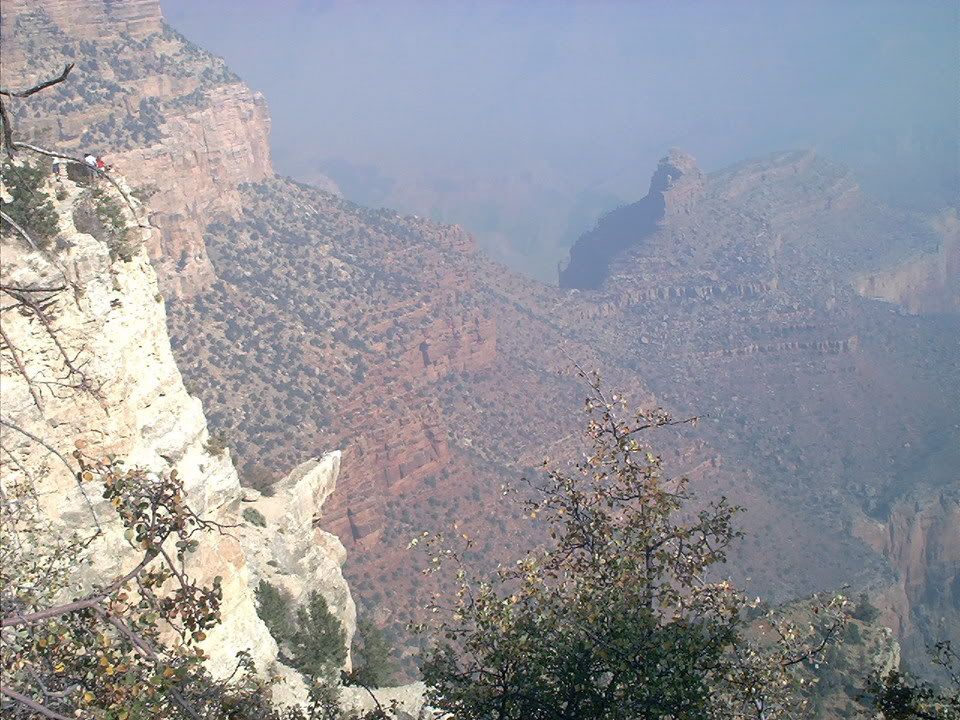
Y'all seen the 'Dave Sphinx' in Grand Canyon?...
even the people in uppper left are amazed..lol..
Well...sorta....but I still say put down the bong...lololol....z
Can you see it now?

Bing Maps are far more current (especially Birds eye)..
although I miss
the measruing tools, & assorted features that
Google has.
Google Earth Tips.
They have eliminated a lot of the water imagery around and close to islands/land.
You can pick View, and check Historical Imagery to see these images again. You can also see images that were taken in the past.
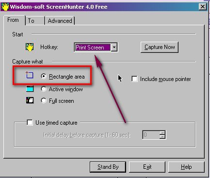
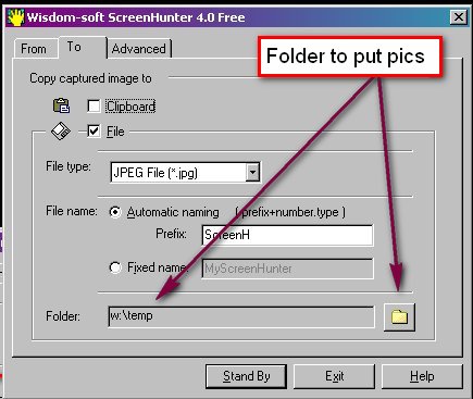
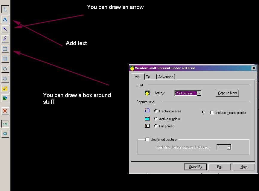
How to use ScreenHunter and FastStone:
http://wisdom-soft.com/products/screenhunter_free.htm
http://www.faststone.org/FSViewerDownload.htm
The following uses screenshots of screenhunter. Took pictures of itself....lol

If you have any other tips, let me know and I'll add them to this sticky......z
Coral Necklace:
7° 29.537'N, 155° 16.114'E
z
But but but.....LMFAO
Crashin right now. I fix in the morning. :)
I think you should put down the bong....lol...I sent you a link so you could draw on images.....et z
Right smack dab in the middle is the one eye.........
So where's the face?.......et z
Google Earth Tips.
They have eliminated a lot of the water imagery around and close to islands/land.
You can pick View, and check Historical Imagery to see these images again...
If you have any other tips, let me know and I'll add them to this sticky......z
Glad you said it and not me.....lololol......et z
I don't like this new under the ocean crap. Just hoping that we can see the ocean surface again with the new version......but looks like the site is having problems......can't download v5......z
Hey..just had an idea....people could post screenshots, and then we could have 20 questions or something to try to find out where it is.....z
Either or both....don't matter...whatever floats your boat.....lol.......z
I don't get it zardiw. Are we only posting coordinates to punch into google earth or are we posting the actual picture?
Dubai Flowers
25° 3.552'N, 55° 2.308'E
z
I don't see it....Post a screen shot and highlight it:
http://wisdom-soft.com/products/screenhunter_free.htm
.et z
How to Post/Go to a Place Mark:
First create it if you haven't already.
Then right click on it and pick: Properties
Then copy the Lattitude paste it in your post.
Then add a comma.
Then copy the Longitude paste it in your post.
Like This:
21° 18.098'N, 106° 14.208'W
To go to a placemark, just copy the whole line, and paste it into Google Earth.
z
So simple even a woman can do it. :)
Skull 30° 4'27.17"N,36°43'47.48"E
Devil Face? 30°22'24.99"N, 34° 6'34.60"E
How to get Google Earth:
Go here, download and install: http://earth.google.com/
z
How to Post a Place Mark:
First create it if you haven't already.
Then right click on it and pick: Properties
Then copy the Lattitude paste it in your post.
Then add a comma.
Then copy the Longitude paste it in your post.
Like This:
21° 18.098'N, 106° 14.208'W
z
Post all your cool placemarks here:
For those of you who have no clue what Google Earth is:
http://earth.google.com/
It allows you to soar and explore the entire planet!
z
|
Followers
|
2
|
Posters
|
|
|
Posts (Today)
|
0
|
Posts (Total)
|
51
|
|
Created
|
09/19/09
|
Type
|
Premium
|
| Moderator Zardiw | |||
| Assistants FoodStamps4stocks | |||

| Volume | |
| Day Range: | |
| Bid Price | |
| Ask Price | |
| Last Trade Time: |


.JPG)