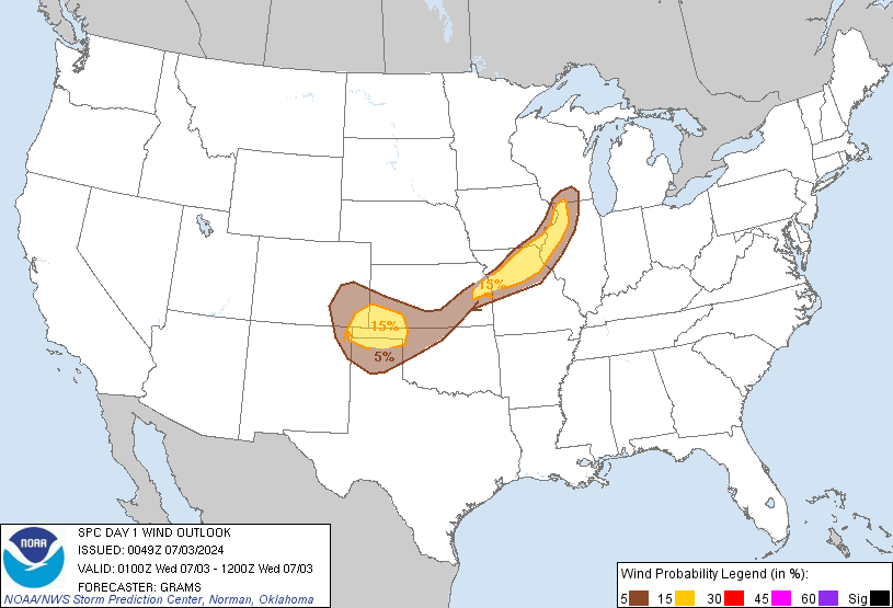
fuagf, and all in Texas -- in apparently about 5-7 hours here, a risk of severe -- current outlook maps (will update to tomorrow's outlook at 1200Z) -- we're just within the northern extent:
and this is one of those 100% it's definitely coming deals, pretty much everyone everywhere within the outlooked area is going to be affected (at least some strong if not severe wind) -- event already under way and rather conspicuously on the move (and yes, that is a strong little eastward-advancing upper level low, a shortwave aloft, quite directly/visibly driving the event):
having so far generated 8 severe thunderstorm warnings where it is and has been still well west of the outlooked area:
Severe Weather and Flash Flood Warnings College of DuPage Meteorology http://kamala.cod.edu/svr/ [click on the location of the NWS office to bring up the particular warning; click on the location's 4-letter (e.g., currently, 'KMAF') station ID to bring up a list of and view recent severe weather statements issued by that office]
 Market Data
  Markets