After transitioning to neutral conditions, it's possible that sea-surface water temperatures in the equatorial east and central Pacific Ocean could continue to cool to the point that La Niña may emerge in the fall, NOAA said. However, they cautioned that much uncertainty remains, though there is computer model and physical evidence that La Niña conditions could develop.
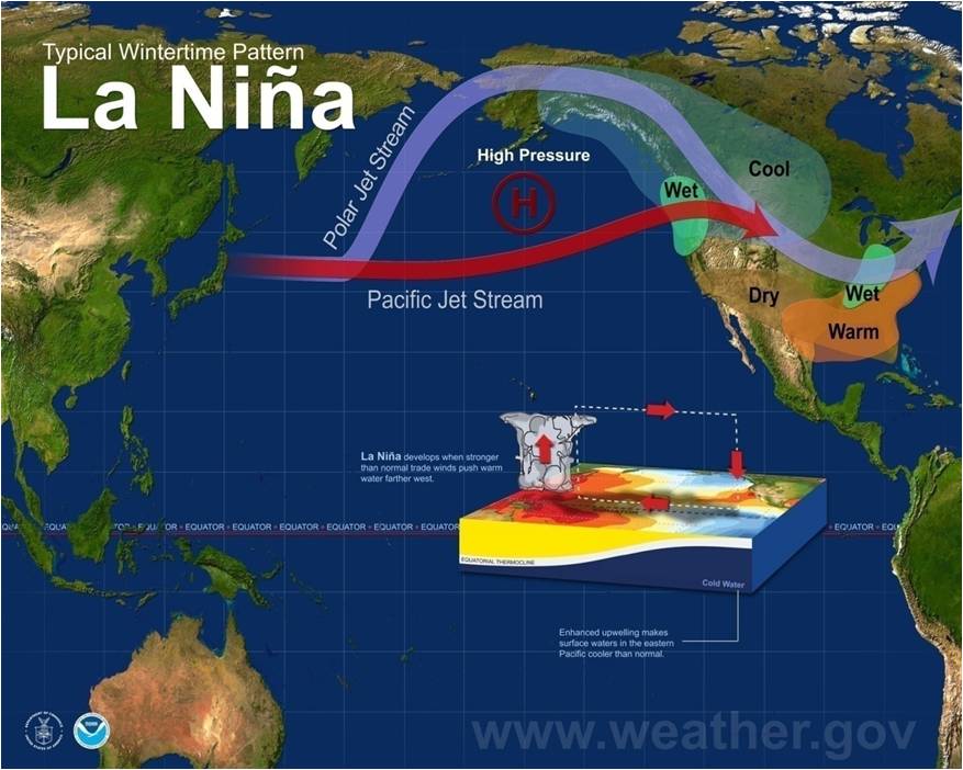
La Niña is the opposite of El Niño, namely, a cooling of the equatorial east-central Pacific Ocean.
Of course, if La Niña does develop, the strength of it (weak, moderate or strong) will determine what impacts it may have on the weather in North America and elsewhere next winter (2016-2017). The downward trend in the graph lines from left to right below illustrates the computer model forecast for cooling SSTs through spring, summer and into next fall
During a strong La Niña, impacts are nearly the opposite from El Niño during late fall and winter.
It's also important to keep in mind:
1) El Niño is not the sole driver of the atmosphere at any time. Day-to-day variability in the weather pattern, including blocking patterns, forcing from climate change and other factors all work together with El Niño to determine the overall weather experienced over the timeframe of a few months.
2) No two El Niños are exactly alike.
Looking at past strong El Niños, as classified by consultant meteorologist Jan Null, here are the most consistent signals we've seen in the data for temperatures and precipitation from February through May in the U.S.:
With investments, past performance doesn't guarantee future results. So, while these impacts have tended to occur in the winters and springs of strong El Niños, factors such as day-to-day variability, blocking of the jet stream, even climate change will also play a role in your overall weather into spring 2016.
 News
News  Market Data
  Discover