


Monday, June 19, 2017 10:18:59 AM
Here's my previous posts on the topic:
http://investorshub.advfn.com/boards/read_msg.aspx?message_id=131838730
http://investorshub.advfn.com/boards/read_msg.aspx?message_id=131839718
https://tinyurl.com/y8adl443
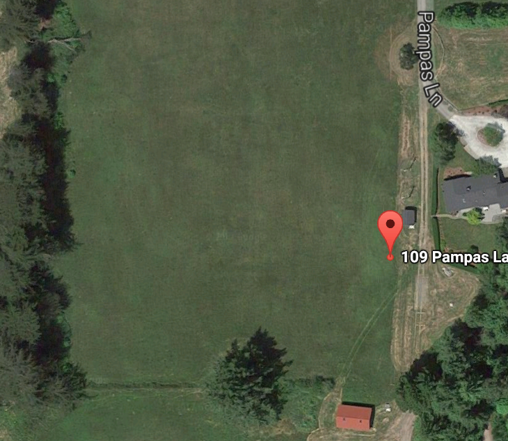
Here's Google's map of the property. Notice the structure with the red roof on the lower part of the image, and the shed and house with the gray roofs on the right part of the image. Also notice the big tree in the center bottom.
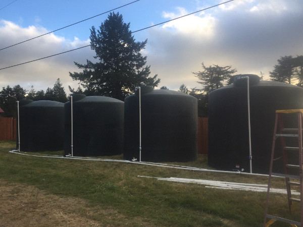
Notice that the red roof can barely be visible on the left edge of the image, so the tanks are positioned at the bottom of the property. Also, that nearest big tree is positioned in a way that is consistent with the tree in the bottom of the google map. Also notice a distinct looking tree with a curved up branches in the center right of the image in the far background.

You can see the same distinct tree with curved branches in this picture of the crops.
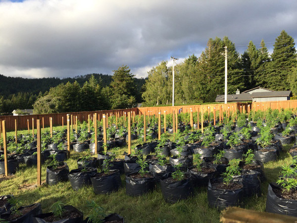
You can see the gray roof house and shed in this image.

You can see the same house in this crop picture.
Glidelogic Corp. Becomes TikTok Shop Partner, Opening a New Chapter in E-commerce Services • GDLG • Jul 5, 2024 7:09 AM
Freedom Holdings Corporate Update; Announces Management Has Signed Letter of Intent • FHLD • Jul 3, 2024 9:00 AM
EWRC's 21 Moves Gaming Studios Moves to SONY Pictures Studios and Green Lights Development of a Third Upcoming Game • EWRC • Jul 2, 2024 8:00 AM
BNCM and DELEX Healthcare Group Announce Strategic Merger to Drive Expansion and Growth • BNCM • Jul 2, 2024 7:19 AM
NUBURU Announces Upcoming TV Interview Featuring CEO Brian Knaley on Fox Business, Bloomberg TV, and Newsmax TV as Sponsored Programming • BURU • Jul 1, 2024 1:57 PM
Mass Megawatts Announces $220,500 Debt Cancellation Agreement to Improve Financing and Sales of a New Product to be Announced on July 11 • MMMW • Jun 28, 2024 7:30 AM

