 News
News  Market Data
  Discover
Support: 888-992-3836
Copyright © 2023 InvestorsHub Inc.


Register for free to join our community of investors and share your ideas. You will also get access to streaming quotes, interactive charts, trades, portfolio, live options flow and more tools.
And now the question is:
Will PDIV file before OTC business opens Monday?
or
Has PDIV given up on its Pink Current status?
I am looking for PDIV to describe its updated relationship with GNCP, USAL, and AMLM.
Lowenthal lied again: filings are late!!!
Anticipated Filing Date:
[Please note that the filing of this notification grants issuers 5 additional calendar days to post a Quarterly or Interim Report and 15 calendar days to post an Annual Report.]
AUGUST 19, 2023
nationalization is coming to claim near you steal from me and its karma it gets stolen from you
Doesn't matter... PDIV is front loaded...TOXIC NOTES
Notes conversions value close to $65M
Can you speel DILUTION ?

Good luck whoever owns this looks like there is a Craig Scott that worked for Barrick not sure if its the same guy mentioned
Provide link proving PDIV owns claims
You won't find any
That's how it really works
PDIV is toxic... just look t the financials...
2 New filings out
https://www.otcmarkets.com/stock/PDIV/disclosure
n a mining claim?
Your right to the property is restricted to exploration, development and extraction of a mineral deposit at the site. The surface of almost all unpatented mining claims is not private property; the ownership and management of the surface and surface resources remains with the United States.
https://www.blm.gov › files › files
And the claims I sent you are right there and they are recorded for the public records
If it’s recorded in a courthouse then it’s a valid cliam that’s the way it’s works
Easy: they OWN no Claims and no Mines
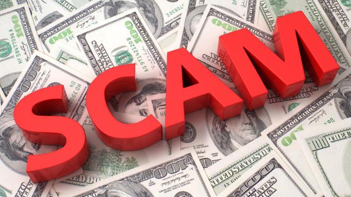
PDIV jis just another classic Bauman-Lowenthal-Lumb TOXIC SCAM
They done. I’made so many companies it’s hard to tell we’re they at even the oatman claims we’re are they king Midas and all those mines
Lol
ALSPA IS A DEAD COMPANy: permanently tevoked!!!


Aspa is a gold company and a 53% subsidiary of either pdiv or Gncp 1or other not sure which I was wondering where the rest of those claims were now I found them they were under this ticker
ASPA Gold Corp was incorporated as ESE Corp. on April 27, 2005 under the laws of the State of Nevada. Effective January 6, 2010, the Company changed its name from ESE Corp. to Renaissance BioEnergy Inc. In November 2010, Renaissance BioEnergy Inc changed its name to ASPA Gold Corp. and its business plan to gold exploration and development. The Company is an exploration stage company and is concentrating substantially all of its efforts in acquiring interests in mining claims and leases for the Oatman Gold Project, located in Mohave County in the state of Arizona, and implementing its business plan to explore and develop its mining claims. The Oatman Gold Project includes the 'Argo', 'King Midas' and 'Lexington' Gold Mines. The 'Argo Gold Mine' is located on the Tom Reed gold vein. The first work done on the Tom Reed vein was in 1901 when the Gold Road Company sank the Tom Reed and Ben Harrison shafts to a depth of 100 feet. The 'King Midas Gold Mine' is located on the next parallel vein south of the Tom Reed vein. The workings consist of a 310-foot shaft and several surface cuts on the footwall of an outcrop of a weathered, northwest southeast striking rhyolitic dike. Laterals are reported at the 100-foot, 200-foot and 200 foot levels, with several hundred feet of lateral drifting from the shaft. The 'Lexington Gold Mine' is a gold deposit, located on private property south of the 'King Midas Gold Mine', and includes approximately 90 acres of patented mineral rights with almost a mile of a gold vein system comprised of three known ore bearing veins. Several of the Company's unpatented mining claims maybe located to the probable southeast extensions of the mineralized vein structures exploited at the 'Lexington Gold Mine' Group.
Last April news release from GNCP
Only problem, GNCP no longer has rights in NV, PDIV reclaimed them.
Now could the geologist be Craig Alford (CEO) of CDSG and BRLL , like it was rumored months ago? with chairman Hyping Harpreet Sangha ? Do the DD on the past ventures from those 2 characters. Alford go sued by his own company back then. Interesting and intriguing
Buyers Beware...

GNCC CAPITAL, INC. TO PROVIDE DETAILED UPDATE
Press Release | 04/22/2022
GNCC CAPITAL, INC. TO PROVIDE DETAILED UPDATE
PR Newswire
LAS VEGAS, April 22, 2022
LAS VEGAS, April 22, 2022 /PRNewswire/ -- GNCC Capital, Inc. (GNCP.PK) ("The Company", "GNCC" or "GNCP") acknowledges the innumerable E Mail from our shareholders.
We recognize that our shareholders appear very eager to receive an update on a number of issues including the completion of our new corporate website and interim exploration strategy for our recent transaction of "Silverpeak"; those being the Lithium and Uranium Properties in Nevada.
Your Directors are preparing an update to address these issues and will disseminate a detailed Press Release.
Shareholders are asked to please respect that your Directors have been inundated in work pertaining to the new website, detailed Reports and the exploration planning for "Silverpeak".
Exploration planning for the "Silverpeak" Project is complex and we are retaining both a Geologist and a "turnkey" exploration company that both specialize in both Lithium and Uranium Exploration and Extraction and in that area of Nevada. The same Geologist and firm are currently dealing with our partners exploration work in the same geographical area; which was one of our main attractions to close these transactions as we successfully achieved.
Shareholders are encouraged to E Mail issues of concern or of interest to ourselves. If pertinent, we will address in this Update.
We will also be addressing and will dispel a number of false rumors being disseminated on the Internet Stock Chat Forums that are serving to mislead and to sow confusion amongst our shareholders.
We trust that this will provide clarity and reassurance to our shareholders.
Courtesy of Mentor Eli's Gone:
The TA for PDIV is Transfer Online who is "Transfer Agent Verified" and has well over a hundred clients---they provide current AS, OS, restricted, non-restricted, DTCC share counts for all of them on a routine basis---except one--you guessed it---PDIV---wonder why smile
https://www.otcmarkets.com/learn/service-providers/2454?t=6
PDIV needs to up the AS to accommodate all those notes that magically appeared as their AS is maxed out---and/or they need to create classes of preferred if they choose to go that route as they have none currently...
speaking of shares, Precious Metals High Growth (Lumb now Kobeski) held ~247M of the ~248M OS until April 2021 when they parceled a bunch of them out to Logical Trading (Aspinall) and 2 unknowns which are now eligible to come off restriction and become free trading---wonder why that info is hidden?.....the pump is primed smile
pg 4:
https://www.otcmarkets.com/otcapi/company/financial-report/289348/content
Lonely guy jerking up PDIV
EXTREMELY LOW VOLUME
EXTREMELY LOW DOLLARS EXCHANGED
PDIV IS PLUMMED WITH TOXIC NOTES FROM THE 3 amigos accociated in scam:
SEC crook charged Frederick C Baumam, Ronald Lowenthal and Stephen Lumb

Not at all I ask a good question about what it is a selfish company like the other
I think most has no value except 0,0001 or 0,0000001
Between you cannot know exactly
Why so long to get few
Except if all the company you have get it
As you
Pdiv price is the same as CDSG -what does that mean
PDIV Toxic Front Loading: $64.9M dilutive power
The fake deals happened in 2017 and were only disclosed in 2022.
They consist in WAY OVERPRICED OPTIONS (still unexercized to this day) on non productive claims.
From the scamming team Bauman(Anaconda + Searchlight) /Lowenthal/ Lumb crew
naconda Exploration LLC
6440 Sky Pointe Drive Suite 140-149
Las Vegas, Nevada 89131
Anaconda Exploration LLC is a corporation claimant based in Las Vegas, Nevada for 102 mining claims—32 are active and 70 are closed.
Quick Facts
Anaconda Exploration LLC is a corporation entity
Named as a claimant in the listed claims
Anaconda Exploration LLC is listed with 102 total claims
32 claims are active
70 claims are closed
Anaconda Exploration LLC of Las Vegas, Nevada | 102 Mining Claims
LLC
Overview
Middle Verde Development Co.
Map
Claims
242
Nearby
1
Owners
Middle Verde Development Co.
6440 Sky Pointe Drive Suite 140-149
Las Vegas, Nevada 89131
Middle Verde Development Co. is a corporation claimant based in Las Vegas, Nevada for 242 mining claims—42 are active and 200 are closed.
Quick Facts
Middle Verde Development Co. is a corporation entity
Named as a claimant in the listed claims
Middle Verde Development Co. is listed with 242 total claims
42 claims are active
200 claims are closed
Middle Verde Development Co. of Las Vegas, Nevada | 242 Mining Claims
Middle Verde Development Co. of Las Vegas, Nevada | 242 Mining Claims
Click to open an interactive map.
© The Diggings™
Mining Claims
Disposition
FLAT IRON Active
HONDO MILL SITE #6 Active
HONDO MILL SITE #2 Active
HONDO MILL SITE #3 Active
HONDO MILL SITE #5 Active
Show more
Owners At The Same Street Address
Mining claim entities located at the same street address in Las Vegas, Nevada as Middle Verde Development Co.. These could be different entities opperating out of the same location—like a shared office space, PO Box, or family home—or one entity with multiple mine ID numbers.
Corporation
Searchlight Exploration LLC
Relationship:Claimant Category:Corporation Claims:198 Current Claims:181 Current Acres:3,685.34
Corporation
Searchlight Exploration LLC
Relationship:Claimant Category:Corporation Claims:536 Current Claims:118 Current Acres:2,433.26
Corporation
Anaconda Exploration LLC
Relationship:Claimant Category:Corporation Claims:102 Current Claims:32 Current Acres:655.84
Corporation
Searchlight Strategic Resources LLC
Relationship:Claimant Category:Corporation Claims:11 Current Claims:8 Current Acres:165.28
1 of 4
Nearby Owners
Mining claim entities located near Middle Verde Development Co.. While entities may have multiple locations, this is based on the address registered for the claim.
Corporation
Southern Nevada Liteweight Inc.
7300 Afternoon Street
Las Vegas, NV 89131
Relationship:Claimant Category:Corporation Claims:24 Current Claims:24 Current Acres:491.02
List all nearby owners
1 of 2
Mining Claim News From The Diggings™
Learn more about the Bureau of Land Management, Public Land Survey System, and mining claims.
Understanding Mine Ownership
Understanding Claim Ownership
We receive lots of emails from people who find their name or a relative’s name on our site and want to know if this means they have some right to the land listed under that name.
open range landscape
Understanding BLM Administrative Areas
Whether it is filing a mine or researching one, the administering BLM office is going to be the definitive source.
Public Land Survey System map of the United States of America
Understanding Location Data
Mine handled by the Bureau of Land Management are not mapped by latitude and longitude, instead, these mines harken back to the Public Land Survey System.
Historic map of the Ohio Western Reserve
Understanding Townships
A “township” can refer to two different things. Both are part of the PLSS measurement system but have different uses.
1 of 4
Share on Facebook
Share on Twitter
Share on LinkedIn
Share on Tumblr
Share on Pinterest
Stay Up To Date
Join our mailing list to get alerts for mine listing updates, new features, and special opportunities.
Email Address *
The Diggings™
Information hosted on The Diggings™ is based on publicly available data through the Bureau of Land Management. The Diggings™ accepts no liability for the content of this data, or for the consequences of any actions taken on the basis of the information provided.
The Diggings™ makes no warranty, expressed or implied, including the warranties of merchantability and fitness for a particular purpose, nor assumes any legal liability or responsibility for the accuracy, reliability, completeness or utility of these geospatial data, or for the improper or incorrect use of these geospatial data. These geospatial data and related maps or graphics are not legal documents and are not intended to be used as such. The data and maps may not be used to determine title, ownership, legal descriptions or boundaries, legal jurisdiction, or restrictions that may be in place on either public or private land. Natural hazards may or may not be depicted on the data and maps, and land users should exercise due caution. The data are dynamic and may change over time. The user is responsible to verify the limitations of the geospatial data and to use the data accordingly.
MINES
BY LOCATION
BY BLM ADMINISTRATIVE AREA
OWNERS
BY NAME
BY LOCATION
BY STATE
BY CATEGORY
BY RELATIONSHIP
RESOURCES
ABOUT
GETTING STARTED
FREQUENTLY ASKED QUESTIONS
LAW GLOSSARY
DICTIONARY
ADVERTISE WITH US
CONNECT
NEWS
MAILING LIST
CONTACT US
BLOG
TWITTER
FACEBOOK
PINTEREST
YOUTUBE
VIMEO
LINKEDIN
The Diggings™
3903 Volunteer Drive Suite 200
Chattanooga TN, 37416
© The Diggings™, 2023 Terms of Use Privacy Policy
The BLM Collection
The Drillings™
Oil & Gas Leases
The Coal Fields™
Coal Claims
The Land Patents™
Land Patents
The Recreation Sites™
Outdoor Activity Land Claims
The Watersheds™
Water Rights
Back to top
A RAPTIVE PARTNER SITE
Really does it???
Have you seen those many pages of convertible notes in the filings??? Those paint a clear picture of what is coming!!!
PDIV leases right of use... soft assets
All while being toxically financed by the scamming trio SEC charged Frederick C Bauman + Lowenthal + Stephen Craig Lumb.
They front loaded and own notes worth up to $56,97M in post conversion money. Can you spell TOXIC ???
Buyers beware... Share selling scam
Bids are starting to stack. With this type of setup all it takes is a couple guys and boom.
PDIV $40 million in assets. 350k floating and material events coming next week per the company.
#PDIV Premier Development & Investment, Inc. (OTC:PDIV) confirms material announcements next week including appointment of Head of our Mining Exploration Interests. We will also address our interests in GNCC Capital, Inc. #GNCP at that time. @gncccapital
— @Pdivpremier (@PdivPremier) July 20, 2023
$PDIV: Looking pretty interesting here at 0.43
Maybe I can add a few at $0.35
Will see this
GO $PDIV
Tweet > Material Announcements coming next week!
Bauman been crooked for a long time
Part of the Bauman-Lowenthal-Lumb scamming team, they've been at it for a long time
Continuation of the Bauman-Lowenthal-Lumb share selling scam
Searchlignt is Frederick Bauman...SEC charged !!!
Claims
Listed as: SEARCHLIGHT STRATEGIC RESOURCES LLC
Overview
Searchlight Strategic Resources LLC
Map
Claims
11
Nearby
1
Owners
Searchlight Strategic Resources LLC
6440 Sky Pointe Drive Suite 140-149
Las Vegas, Nevada 89131
Searchlight Strategic Resources LLC is a corporation claimant based in Las Vegas, Nevada for 11 mining claims—8 are active and 3 are closed.
Quick Facts
Searchlight Strategic Resources LLC is a corporation entity
Named as a claimant in the listed claims
Searchlight Strategic Resources LLC is listed with 11 total claims
8 claims are active
3 claims are closed
Searchlight Strategic Resources LLC of Las Vegas, Nevada | 11 Mining Claims
Searchlight Strategic Resources LLC of Las Vegas, Nevada | 11 Mining Claims
Click to open an interactive map.
© The Diggings™
Mining Claims
Disposition
IRON LAMP Active
ALL AMERICAN Active
RARE METALS Active
BONEEKAY #2 Active
M&E PRIDE Active
Show more
Owners At The Same Street Address
Mining claim entities located at the same street address in Las Vegas, Nevada as Searchlight Strategic Resources LLC. These could be different entities opperating out of the same location—like a shared office space, PO Box, or family home—or one entity with multiple mine ID numbers.
Corporation
Searchlight Exploration LLC
Relationship:Claimant Category:Corporation Claims:198 Current Claims:181 Current Acres:3,685.34
Corporation
Searchlight Exploration LLC
Relationship:Claimant Category:Corporation Claims:536 Current Claims:118 Current Acres:2,433.26
Corporation
Middle Verde Development Co.
Relationship:Claimant Category:Corporation Claims:242 Current Claims:42 Current Acres:737.99
Corporation
Anaconda Exploration LLC
Relationship:Claimant Category:Corporation Claims:102 Current Claims:32 Current Acres:655.84
1 of 4
Nearby Owners
Mining claim entities located near Searchlight Strategic Resources LLC. While entities may have multiple locations, this is based on the address registered for the claim.
Corporation
Southern Nevada Liteweight Inc.
7300 Afternoon Street
Las Vegas, NV 89131
Relationship:Claimant Category:Corporation Claims:24 Current Claims:24 Current Acres:491.02
List all nearby owners
1 of 2
Mining Claim News From The Diggings™
Learn more about the Bureau of Land Management, Public Land Survey System, and mining claims.
Understanding Mine Ownership
Understanding Claim Ownership
We receive lots of emails from people who find their name or a relative’s name on our site and want to know if this means they have some right to the land listed under that name.
open range landscape
Understanding BLM Administrative Areas
Whether it is filing a mine or researching one, the administering BLM office is going to be the definitive source.
Public Land Survey System map of the United States of America
Understanding Location Data
Mine handled by the Bureau of Land Management are not mapped by latitude and longitude, instead, these mines harken back to the Public Land Survey System.
Historic map of the Ohio Western Reserve
Understanding Townships
A “township” can refer to two different things. Both are part of the PLSS measurement system but have different uses.
1 of 4
Share on Facebook
Share on Twitter
Share on LinkedIn
Share on Tumblr
Share on Pinterest
Stay Up To Date
Join our mailing list to get alerts for mine listing updates, new features, and special opportunities.
Email Address *
The Diggings™
Information hosted on The Diggings™ is based on publicly available data through the Bureau of Land Management. The Diggings™ accepts no liability for the content of this data, or for the consequences of any actions taken on the basis of the information provided.
The Diggings™ makes no warranty, expressed or implied, including the warranties of merchantability and fitness for a particular purpose, nor assumes any legal liability or responsibility for the accuracy, reliability, completeness or utility of these geospatial data, or for the improper or incorrect use of these geospatial data. These geospatial data and related maps or graphics are not legal documents and are not intended to be used as such. The data and maps may not be used to determine title, ownership, legal descriptions or boundaries, legal jurisdiction, or restrictions that may be in place on either public or private land. Natural hazards may or may not be depicted on the data and maps, and land users should exercise due caution. The data are dynamic and may change over time. The user is responsible to verify the limitations of the geospatial data and to use the data accordingly.
MINES
BY LOCATION
BY BLM ADMINISTRATIVE AREA
OWNERS
BY NAME
BY LOCATION
BY STATE
BY CATEGORY
BY RELATIONSHIP
RESOURCES
ABOUT
GETTING STARTED
FREQUENTLY ASKED QUESTIONS
LAW GLOSSARY
DICTIONARY
ADVERTISE WITH US
CONNECT
NEWS
MAILING LIST
CONTACT US
BLOG
TWITTER
FACEBOOK
PINTEREST
YOUTUBE
VIMEO
LINKEDIN
The Diggings™
3903 Volunteer Drive Suite 200
Chattanooga TN, 37416
© The Diggings™, 2023 Terms of Use Privacy Policy
The BLM Collection
The Drillings™
Oil & Gas Leases
The Coal Fields™
Coal Claims
The Land Patents™
Land Patents
The Recreation Sites™
Outdoor Activity Land Claims
The Watersheds™
Water Rights
Back to top
Information from your device can be used to personalize your ad experience.
Do not sell or share my personal information.
A RAPTIVE PARTNER SITE
Claims
Listed as: SEARCHLIGHT STRATEGIC RESOURCES LLC
Overview
Searchlight Strategic Resources LLC
Map
Claims
11
Nearby
1
Owners
Searchlight Strategic Resources LLC
6440 Sky Pointe Drive Suite 140-149
Las Vegas, Nevada 89131
Searchlight Strategic Resources LLC is a corporation claimant based in Las Vegas, Nevada for 11 mining claims—8 are active and 3 are closed.
Quick Facts
Searchlight Strategic Resources LLC is a corporation entity
Named as a claimant in the listed claims
Searchlight Strategic Resources LLC is listed with 11 total claims
8 claims are active
3 claims are closed
Searchlight Strategic Resources LLC of Las Vegas, Nevada | 11 Mining Claims
Searchlight Strategic Resources LLC of Las Vegas, Nevada | 11 Mining Claims
Click to open an interactive map.
© The Diggings™
Mining Claims
Disposition
IRON LAMP Active
ALL AMERICAN Active
RARE METALS Active
BONEEKAY #2 Active
M&E PRIDE Active
Show more
Owners At The Same Street Address
Mining claim entities located at the same street address in Las Vegas, Nevada as Searchlight Strategic Resources LLC. These could be different entities opperating out of the same location—like a shared office space, PO Box, or family home—or one entity with multiple mine ID numbers.
Corporation
Searchlight Exploration LLC
Relationship:Claimant Category:Corporation Claims:198 Current Claims:181 Current Acres:3,685.34
Corporation
Searchlight Exploration LLC
Relationship:Claimant Category:Corporation Claims:536 Current Claims:118 Current Acres:2,433.26
Corporation
Middle Verde Development Co.
Relationship:Claimant Category:Corporation Claims:242 Current Claims:42 Current Acres:737.99
Corporation
Anaconda Exploration LLC
Relationship:Claimant Category:Corporation Claims:102 Current Claims:32 Current Acres:655.84
1 of 4
Nearby Owners
Mining claim entities located near Searchlight Strategic Resources LLC. While entities may have multiple locations, this is based on the address registered for the claim.
Corporation
Southern Nevada Liteweight Inc.
7300 Afternoon Street
Las Vegas, NV 89131
Relationship:Claimant Category:Corporation Claims:24 Current Claims:24 Current Acres:491.02
List all nearby owners
1 of 2
Mining Claim News From The Diggings™
Learn more about the Bureau of Land Management, Public Land Survey System, and mining claims.
Understanding Mine Ownership
Understanding Claim Ownership
We receive lots of emails from people who find their name or a relative’s name on our site and want to know if this means they have some right to the land listed under that name.
open range landscape
Understanding BLM Administrative Areas
Whether it is filing a mine or researching one, the administering BLM office is going to be the definitive source.
Public Land Survey System map of the United States of America
Understanding Location Data
Mine handled by the Bureau of Land Management are not mapped by latitude and longitude, instead, these mines harken back to the Public Land Survey System.
Historic map of the Ohio Western Reserve
Understanding Townships
A “township” can refer to two different things. Both are part of the PLSS measurement system but have different uses.
1 of 4
Share on Facebook
Share on Twitter
Share on LinkedIn
Share on Tumblr
Share on Pinterest
Stay Up To Date
Join our mailing list to get alerts for mine listing updates, new features, and special opportunities.
Email Address *
The Diggings™
Information hosted on The Diggings™ is based on publicly available data through the Bureau of Land Management. The Diggings™ accepts no liability for the content of this data, or for the consequences of any actions taken on the basis of the information provided.
The Diggings™ makes no warranty, expressed or implied, including the warranties of merchantability and fitness for a particular purpose, nor assumes any legal liability or responsibility for the accuracy, reliability, completeness or utility of these geospatial data, or for the improper or incorrect use of these geospatial data. These geospatial data and related maps or graphics are not legal documents and are not intended to be used as such. The data and maps may not be used to determine title, ownership, legal descriptions or boundaries, legal jurisdiction, or restrictions that may be in place on either public or private land. Natural hazards may or may not be depicted on the data and maps, and land users should exercise due caution. The data are dynamic and may change over time. The user is responsible to verify the limitations of the geospatial data and to use the data accordingly.
MINES
BY LOCATION
BY BLM ADMINISTRATIVE AREA
OWNERS
BY NAME
BY LOCATION
BY STATE
BY CATEGORY
BY RELATIONSHIP
RESOURCES
ABOUT
GETTING STARTED
FREQUENTLY ASKED QUESTIONS
LAW GLOSSARY
DICTIONARY
ADVERTISE WITH US
CONNECT
NEWS
MAILING LIST
CONTACT US
BLOG
TWITTER
FACEBOOK
PINTEREST
YOUTUBE
VIMEO
LINKEDIN
The Diggings™
3903 Volunteer Drive Suite 200
Chattanooga TN, 37416
© The Diggings™, 2023 Terms of Use Privacy Policy
The BLM Collection
The Drillings™
Oil & Gas Leases
The Coal Fields™
Coal Claims
The Land Patents™
Land Patents
The Recreation Sites™
Outdoor Activity Land Claims
The Watersheds™
Water Rights
Back to top
Information from your device can be used to personalize your ad experience.
Do not sell or share my personal information.
A RAPTIVE PARTNER SITE
Interesting judgement about GEOXPLORE CEO
BC Securities about GEOXPLOR CEO Edward Clive Ashworth And mining claims selling scheme...
Ashworth's conduct in delivering 280,000 shares to Hooi and Voong, in our view, provides confirmation of the true consideration paid for the three groups of claims and therefore the value of the claims. We find that Ashworth knew that the value of the claims was significantly less than the consideration set out in the three sale agreements, and that at least 280,000 shares issued to him under those agreements were issued by Canada Orient for no value. We therefore find that Ashworth contravened section 41.1 of the Act by engaging in a scheme relating to trades in 280,000 shares of Canada Orient when he knew that the scheme perpetrated a fraud on Canada Orient.
GeoXplor Corporation
3655 West Anthem Way
Suite 109 – 293
Anthem, AZ 85086
If directed to Purchaser :
Lucky Boy Silver Corp.
5466 Canvasback Rd.
Blaine, WA 98230
All notices shall be deemed delivered upon receipt.
12. Survival.
The representations, warranties and covenants contained herein shall survive the execution and delivery of this Agreement and Closing.
13. Brokers
Purchaser and Seller each warrants to the other that is has not engaged, consented to, or authorized any broker, investment banker, or other third party to act on it’s behalf, directly or indirectly, as a broker or finder in connection with the transactions contemplated by this Agreement and no such third party is entitled to any fee or compensation in connection with this Agreement or the transactions contemplated hereby reason of any action of it.
14. Amendment and Modification.
This agreement may be amended, modified or supplemented only by written Agreement of Purchaser and Seller.
15. Severability.
Any provision of this Agreement that shall be prohibited or unenforceable shall be deemed null and void without invalidating the remaining provisions hereof.
16. Entire Agreement.
This Agreement sets forth all of the promises, covenants, Agreements, conditions and undertakings between the parties hereto with respect to the subject matter hereof, and supersedes all prior and contemporaneous Agreements and undertakings, inducements or conditions, express or implied, oral or written.
17. Governing Law.
This Agreement shall be governed by and constructed in accordance with the laws of the State of Nevada.
18. Counterparts.
This Agreement may be executed in one or more counterparts all of which when taken together constitute one and the same instruments. A signed counterpart is as binding as an original.
19. Headings, Exhibits.
The headings used in this Agreement are for convenience only and shall not be used to limit or construe the contents of any sections of this Agreement. All lettered Schedules are attached to and by this reference made part of this Agreement.
20. Binding Effect.
This Agreement shall be binding upon and inure to the benefit of the parties hereto, their successors and assigns.
IN WITNESS WHEREOF, the parties hereto have executed this Agreement as of the date and year first above written.
Purchaser :
Lucky Boy Silver Corp. GeoXplor Corporation.
By: By:
/s/ Ken Liebscher /s/ Clive Ashworth
Ken Liebscher, President Clive Ashworth
Schedule “A”
Schedule A
VC Lode Mineral Claims
Carson City, Nevada
Claim Name Claim Number NMC # County File #
VC 1 1065613 419294
VC 2 1065614 419295
VC 3 1065615 419296
VC 4 1065616 419297
VC 5 1065617 419298
VC 6 1065618 419299
VC 7 1065619 419300
VC 8 1065620 419301
VC 9 1065621 419302
VC 10 1065622 419303
VC 11 1065623 419304
VC 12 1065624 419305
VC 13 1065625 419306
VC 14 1065626 419307
VC 15 1065627 419308
VC 16 1065628 419309
VC 17 1065629 419310
VC 18 1065630 419311
VC 19 1065631 419312
VC 20 1065632 419313
0.01 2 exhibit10-01.htm PURCHASE AGREEMENT DATED JUNE 12, 2009 Exhibit 10.01
Exhibit 10.01
PURCHASE AGREEMENT
BY THIS PURCHASE AGREEMENT effective as of the 15th day of June, 2009 (the “Effective Date”),
BY AND BETWEEN
GEOXPLOR CORP., a Nevada corporation, whose address is 3655 West Anthem Way, Anthem, Arizona 85080 (“GeoXplor”),
AND
AMERICAN LITHIUM MINERALS, INC., a Nevada corporation, whose address is 2850 W. Horizon Ridge Parkway, Suite 200, Henderson, NV 89052 ("ALM"),
GeoXplor, in consideration of the agreements set forth herein, has granted certain rights to ALM under the following terms and conditions:
1.
Grant; Definitions
a.
Exploration License – GeoXplor hereby grants to ALM an exclusive license to enter upon the "Property" together with the right to conduct "Mineral Exploration" during the a five-year evaluation and due diligence term.
b.
Definitions - The words and phrases used in this Agreement shall have the following meanings:
(1)
The "Property" shall include those certain unpatented placer mining claims situated in Esmeralda County, Nevada, more particularly described in Exhibit A attached hereto.
(2)
"Mineral Exploration and Development Testing" shall include those activities that ALM, in its sole judgment and discretion, may deem advisable for the purpose of ascertaining any facts relating to the occurrence, nature and extent of lithium carbonate and related lithium compounds or mineralization in and under the Property and the metallurgical and physical properties of such minerals; including, but not limited to, surface trenching, excavations, geophysical and geochemical surveys, drilling, the sinking of shafts for bulk sampling, and further including the right to use the surface for access, to place and use facilities on the surface and to use water and other surface resources that may be useful or convenient in connection with such activities. Mineral Exploration and Development Testing shall specifically include such testing as may be required for filings with any applicable stoc k exchange.
Page | 2
(3)
“Shares” means fully paid and non-assessable common shares in the capital of ALM, issued pursuant to exemptions from registration and prospectus requirements contained in the United States Securities Act of 1933 and the rules and regulations promulgated thereunder, which Shares shall contain such restrictive legends regarding applicable hold periods as required by such securities laws.
(4)
“Dollar(s)” or “$” shall mean currency of the United States.
c.
Transfer of Title – Upon ALM’s completion of its obligations under subsection a and b of Section 2 and subsection f of Section 4, GeoXplor shall transfer title of the Property to ALM subject to (1) ALM’s concurrent transfer to GeoXplor of a royalty on the production of lithium carbonate from the Property and (2) a further agreement to pay an additional bonus as specified in subsection c of Section 2 of this Agreement.
2.
Consideration to GeoXplor
a.
Payments and Reimbursements - ALM shall pay GeoXplor in consideration of the grant of the exploration license and other rights granted under this Agreement the following:
(1)
Five Thousand Dollars ($5,000.00) upon the execution of a letter of intent on April 29, 2009, the receipt of which is acknowledged;
(2)
Fifty-Six Thousand Dollars ($56,000.00) upon execution of this Agreement (calculated based on $500.00 per claim multiplied by 53 staked and recorded claims equals $26,500.00 minus $5,000.00 deposit equals $21,000.00 plus $35,000.00 as payment on execution equals $56,000.00);
(3)
Seventeen Thousand Five Hundred Dollars ($17,500.00) upon presentation of a receipt for payment of the filing and claim maintenance fees to the Nevada State Office of the Bureau of Land Management for the filing of 35 “AF” placer claims, it being understood that GeoXplor will be reimbursed for the costs associated with locating claims of Five Hundred Dollars ($500.00) per claim;
(4)
Thirty-Five Thousand Dollars ($35,000.00) or before the date one year from the Effective Date of this Agreement;
(5)
Fifty Thousand Dollars ($50,000.00) or before the date two years from the Effective Date of this Agreement;
(6)
One Hundred Thousand Dollars ($100,000.00) or before the date three years from the Effective Date of this Agreement; and
Page | 3
(7)
One Hundred Thousand Dollars ($100,000.00) or before the date four years from the Effective Date of this Agreement.
b.
Stock Transfer – As additional consideration, the Purchase Price shall include the issuance of 750,000 Shares, subject to such conditions as may be imposed by the rules and regulations of the United States Securities and Exchange Commission, as follows:
(1)
Two Hundred and Fifty Thousand (250,000) Shares on execution of this Agreement;
(2)
Two Hundred and Fifty Thousand (250,000) Shares on or before the date one year from the Effective Date of this Agreement; and
(3)
Two Hundred and Fifty Thousand (250,000) Shares on or before the date two years from the Effective Date of this Agreement.
c.
Conditions for Transfer of Title and Subsequent Limitations –
(1)
At such time as the ALM has completed the payments and stock transfers specified in subsections a and b of this Section 3, and has completed the expenditures for Work specified in subsection f of Section 4, the Property shall be transferred to ALM by Quitclaim Deed.
(2)
Concurrently with the transfer of title to ALM, ALM shall convey to GeoXplor a “Net Value Royalty” on production of lithium carbonate and other lithium minerals from the Property measured by three percent (3%) of the gross proceeds received by the ALM from the sale or other disposition of lithium carbonate or other lithium compounds less (i) transportation of the product from the place of treatment to the purchaser, (ii) all handling and insurance charges associated with the transportation, and (iii) any taxes associated with the sale or disposition of the product (excluding any income taxes of ALM). ALM shall have the further right to purchase up to two percent (2%) of the Net Value Royalty, in whole percentage points, for One Million Dollars ($1,000,000) for each one percent (1%), which right shall be exercised, if at all, within fifty (50) years from and after the conveyance to GeoXpl or.
(3)
If ALM, its assignee or a joint venture including ALM, (i) delivers to its Board of Directors or applicable other management a feasibility study recommending mining of lithium carbonate or other lithium compound from the Property and such Board of management authorizes implementation of a mining plan, or (ii) sells, options, assigns, disposes or otherwise alienates all or a portion of its interest in the Property, ALM shall pay GeoXplor an additional bonus of Five Hundred Thousand Dollars ($500,000) in cash or shares of ALM. The election to obtain cash or shares of ALM shall be at the sole election of GeoXplor.
Page | 4
c.
Method of Making Payments - All payments required under this Agreement may be mailed or delivered to GeoXplor's address or to any single depository as GeoXplor may instruct. Upon making payment to the authorized agent or depository, ALM shall be relieved of any responsibility for the distribution of such payment to GeoXplor. The delivery or the deposit in the mail of any payment hereunder on or before the due date thereof shall be deemed timely payment hereunder.
3.
Inspection
Both GeoXplor or ALM (or their respective agents), may enter upon the Property or processing facilities to inspect the same at such times and upon such notice to the other party as shall not unreasonably or unnecessarily hinder or interrupt the operations of ALM. At such time as a royalty is conveyed to GeoXplor, the royalty document shall include a right of inspection of the Property and the books and records used for the calculation of royalty and the right to audit on an annual basis.
4.
Obligations of ALM
a.
Conduct of Operations – All work performed on the Property by ALM pursuant its rights under this Agreement or by GeoXplor pursuant to its activities as the operator to implement Work authorized by ALM, shall be done in a good and workmanlike manner and in compliance with all state or federal laws and regulations governing such operations.
b.
Protection from Liens – ALM shall pay all expenses incurred or authorized by it in its activities on the Property and shall allow no liens arising from any act of ALM to remain upon the Property; provided, however, that ALM shall not be required to remove any such lien as long as ALM is contesting in good faith the validity or amount thereof.
c.
Indemnity – ALM shall indemnify GeoXplor against and hold GeoXplor harmless from any suit, claim, judgment or demand whatsoever arising out of negligence on the part of ALM in the exercise of any of its rights pursuant to this Agreement, provided that if GeoXplor or any person or instrumentality acting on GeoXplor's behalf shall have been a contributing cause to the event giving rise to such suit, claim, demand or judgment, ALM's obligation to indemnify GeoXplor shall not exceed ALM's liability under the laws applicable to the event giving rise to such suit, claim, demand or judgment. Likewise, GeoXplor shall similarly indemnify ALM from claims arising out of its negligence in the conduct of its activities as operator to implement Work authorized by ALM.
d.
Payment of Taxes – ALM shall pay all taxes levied against the Property and any improvements on the Property. ALM shall have the right to contest, in the courts or otherwise, the validity or amount of any taxes or assessments, before it shall be required to pay the same. If this Agreement is terminated or otherwise expires, any taxes that are ALM's responsibility shall be prorated for the calendar year of expiration or termination as of the date ALM has removed its equipment, facilities and improvements from the Property.
Page | 5
e.
Maintenance – ALM shall timely pay and make the appropriate record of the payment of the claim maintenance fee or any other fee required under state or federal law to maintain the unpatented mining claims included within the Property for each assessment year during which this Agreement continues in force beyond July 1 of the applicable assessment year.
f.
Work Commitment – Before the expiration of five (5) years from the Effective Date, ALM shall expend not less than Two Millions Dollars ($2,000,000) in Mineral Exploration and Development Testing ("Work"). The Work shall be scheduled to expend not less than One Hundred Thousand Dollars ($100,000) during the first year, One Hundred Thousand Dollars ($100,000) during the first year, Two Hundred Thousand Dollars ($200,000) during the second year, Five Hundred Thousand Dollars ($500,000) during the third year, and One Million Two Hundred Thousand Dollars ($1,200,000) during the fourth year. The nature, place and conduct of such Work shall be at the sole discretion of ALM and the amount of the expenditures shall be determined by the direct cost to ALM of Work performed. GeoXplor shall undertake to perform such Work as directed by ALM under Work plans provided to GeoXplor on a periodic or as needed basis. ALM’s performance of Work shall otherwise conform to the Work plan and shall conform to industry standards. Any expenditure in excess of the amount required for any annual period shall be applicable against expenditures required for the succeeding year or years.
5.
Title Matters
a.
Representations and Warranties Related to the Property – GeoXplor represents and warrants to ALM that: (1) the unpatented mining claims constituting the Property have been located and appropriate record made thereof in compliance with the laws of the United States and the laws of the State of Nevada, (2) the claim maintenance fees have been paid for the year beginning on September 1 prior to the effective date of this Agreement and appropriate record made thereof; (3) there is no claim of adverse mineral rights affecting the Property, (4) subject to the paramount interest of the United States, GeoXplor controls the full undivided possessory title to the Property, (5) except as specified in Exhibit A, GeoXplor's possessory right to the Property is free and clear of all liens and encumbrances.
b.
Joint Representations – ALM and GeoXplor jointly represent and warrant that each company: (1) have the full right, power and capacity to enter into this Agreement upon the terms set forth herein, (2) is incorporated, organized and in good standing under the laws of the state of its incorporation and is qualified to do business and is in good standing in the State of Nevada; (3) has obtained all necessary corporate and shareholder approvals and no further action on the part of its directors or shareholders is necessary or desirable to make this Agreement valid and binding; and (4) neither the execution and delivery of this Agreement nor any of the agreement referred to herein or contemplated hereby, nor the consummation of the transactions hereby contemplated conflict with any agreement to which it is a party and by which it is currently bound.
Page | 6
c.
Title Documents; Data – Upon written request of ALM at any time during the term hereof, GeoXplor shall promptly deliver to ALM copies of all title documents affecting the Property that GeoXplor has in its possession. If GeoXplor is in possession or knows the whereabouts of technical data concerning the mineral estate of the Property, GeoXplor shall, at ALM's expense, furnish copies of such materials to ALM or notify ALM of the location of such information.
d.
Title Defects, Defense and Protection – ALM has, during its initial due diligence examination of the Property prior to the Effective Date, examined and approved GeoXplor’s title to the Property. If title to any of the Property is contested or questioned by any person, entity or governmental agency GeoXplor and ALM shall undertake such actions as may be required to perfect, defend or initiate litigation to protect such title. In that event, all costs of such action shall be paid by ALM and shall be a credit toward the Work obligations of subsection f of Section 4.
e.
Amendment and Relocation of Mining Claims – ALM shall have the right, upon prior consultation with GeoXplor, to amend or relocate the unpatented claims which are subject to this Agreement. The location notices of any such amended or related claims shall be approved by GeoXplor.
f.
Change of Law – If the law of the United States concerning acquisition of mineral rights on federally managed lands is repealed, amended, or new legislation is enacted, ALM shall have the right, at its expense, to take whatever action it deems appropriate to preserve a right to explore for, develop, and mine minerals from the Property. If ALM elects to take any action under the terms of this subsection, it shall first notify GeoXplor in writing setting forth the nature of the proposed action and an explanation thereof. GeoXplor agrees to cooperate with ALM and execute whatever documents are deemed necessary by ALM to accomplish such action. Nothing in this subsection shall impose any obligation upon ALM to take any action, or diminish the right of GeoXplor to take action it deems appropriate; provided, however, that if GeoXplor chooses to take any action, it will first inform ALM of the natur e of such contemplated action.
g.
General – Nothing herein contained and no notice or action which may be taken under this Section 5 shall limit or detract from ALM's right to terminate this Agreement in the manner hereinafter provided.
6.
Termination; Removal of Property; Data
a.
Termination by GeoXplor – If ALM defaults in the performance of its obligations specified in this Agreement, GeoXplor shall give ALM written notice specifying the default. If the default is not cured within thirty (30) days after ALM has received the notice, or if ALM has not within that time begun action to cure the default and does not thereafter diligently prosecute such action to completion, GeoXplor may terminate this Agreement by delivering to ALM written notice of such termination. GeoXplor's right to terminate this Agreement shall be its sole remedy for any failure to make payments required under Section 2. If ALM in good faith disputes the existence of a default, ALM shall initiate appropriate action in a court of competent jurisdiction within the 30-day period and the time to cure shall run from the date of a final determination that a default exists. GeoXplor shall have no ri ght to terminate this Agreement except as set forth in this subsection a of Section 6.
Page | 7
b.
Termination by ALM – ALM shall have the right to terminate this Agreement at any time by written notice from ALM to GeoXplor.
c.
Termination of GeoXplor as Operator – If GeoXplor defaults in the performance of its duties and obligations to perform plans for the performance of Work as specified in subsection f of Section 4 of this Agreement, ALM shall give GeoXplor written notice specifying the default and the same provisions specified in subsection a of this Section 6 shall apply. If the default is not cured, or other appropriate action taken, GeoXplor’s designation as operator shall terminate. The termination of GeoXplor as operator shall not release the ALM from its obligation to complete the expenditures of Work required under subsection f of Section 4.
d.
Effect of Termination – From and after the date of termination of this Agreement by either party, all right, title and interest of the parties under this Agreement shall terminate, and neither party shall be required to make further payments or perform any further obligations hereunder concerning the Property, except payments and obligations, the commitment to pay or the due dates for the payment or performance of which occur prior to the termination date.
e.
Removal of Property – Upon any termination or expiration of this Agreement, ALM shall have a period of three (3) months from and after the effective date of termination within which it may elect to remove from the Property all of its machinery, buildings, structures, facilities, equipment and other property of every nature and description erected, placed or situated thereon, except supports placed in shafts, drifts or openings in the Property. Failure of ALM to so remove the same shall constitute an abandonment by ALM to GeoXplor of the same; provided, however, that ALM may still be required to remove such property upon notice from GeoXplor at any time during the three-month period and thirty (30) days thereafter.
d.
Delivery of Data – If this Agreement is terminated, upon written request given by GeoXplor within thirty (30) days of said termination, ALM shall, within a reasonable time, furnish GeoXplor copies of all available noninterpretive exploration, development and mining data pertaining to the Property prepared by or for ALM.
Page | 8
e.
Relinquishment of Record - If this Agreement is terminated or otherwise expires, ALM shall provide GeoXplor with a recordable document sufficient to provide notice that ALM no longer asserts rights to the Property under this Agreement.
7.
Share Matters
GeoXplor represents and warrants to ALM that is is an “accredited” investor as that term is defined in Rule 501 of Regulation D promulgated under the United States Securities Act of 1933, as amended, and acknowledges and agrees that the Shares will be issued in accordance with all applicable securities laws and will be subject to hold periods and restrictions on resale in accordance with applicable securities laws and it is GeoXplor’s responsibility to determine what those hold periods and restrictions are before selling or otherwise transferring any Shares.
8.
Notices
Any notice or communication required or permitted hereunder shall be effective when personally delivered or deposited, postage prepaid, certified or registered, in the United States mail to the addresses specified above. Either party may, by notice to the other given as aforesaid, change its mailing address for future notices.
9.
Confidentiality
Each of the parties agrees that all information obtained under the terms of this Agreement will not be publicly disclosed or used other than for the activities contemplated hereunder except as required by law or by the rules and regulations of any regulatory authority or stock exchange having jurisdiction or with prior written consent of the other party, such consent not to be unreasonably withheld.
10.
Binding Effect; Assignment
This Agreement shall not be assigned by ALM except to a wholly owned subsidiary, in which case the ALM shall guarantee the performance of the assignee. GeoXplor may assign all or any portion of its right to the royalty provided hereunder.
11.
Force Majeure
If ALM is delayed or interrupted in or prevented from exercising its rights or performing its obligations, as herein provided, by reasons of "force majeure," then, and in all such cases, ALM shall be excused, without liability, from performance of its obligations set forth in this Agreement (except as to obligations to pay money as set forth in Sections 2 and 4), but the provisions shall again come into full force and effect upon the termination of the period of delay, prevention, disability or condition. "Force majeure" includes all disabilities arising from causes beyond the reasonable control of ALM; including, without limitation, acts of God, accidents, fires, damages to facilities, labor troubles, unavailability of fuels, supplies and equipment, orders or requirements of courts or government agencies, or the inability to obtain environmental clearance or operating permits that may be require d by governmental authorities. If a condition of force majeure is declared, the due dates for any performance (excluding time for payment of monies) hereunder shall be extended for the period of the disability.
Page | 9
12.
Memorandum
The parties to this Agreement agree to execute and record a Memorandum of this Agreement in a form sufficient to constitute record notice to third parties of the rights granted hereunder, which may be recorded in the official records of Esmeralda County, Nevada.
13.
Construction
a.
Governing Law - This Agreement shall be construed by the internal laws but not the laws of conflict of the State of Nevada.
b.
Headings - The headings used in this Agreement are for convenience only and shall not be deemed to be a part of this Agreement for purposes of construction.
c.
Entire Agreement - All of the agreements and understandings of the parties with reference to the Property are embodied in this Agreement, and this Agreement supersedes all prior agreements or understandings between the parties.
d.
No Implied Covenants – It is expressly agreed that no implied covenant or condition whatsoever shall be read into this Agreement relating to any time frame as the measure of diligence for any operations of ALM hereunder.
14.
Further Assurances
The parties agree to perform all acts and execute all documents that may be necessary to carry out the spirit and intent of this Agreement.
SIGNED, effective as of the date recited above.
GEOXPLOR CORP.
AMERICAN LITHIUM MINERALS, INC.
By: /s/ John Rud
By /s/ Mathew Markin
Page | 10
State of Arizona
)
)
ss
County of Maricopa
)
Alan Santini is a note holder in PDIV and GNCP and was the CEO of Fortress Financial that was revoked by the SEC. Shady has Fuk.
https://www.tmcnet.com/usubmit/2008/08/25/3617921.htm
Fortress Financial Group, Inc. (PINKSHEETS: FFGO) confirms that the Company's interests in both the "Bouse" and "South
Copperstone" interests are being sold for an amount of US$645,613,390.
This is being settled in shares of quoted Common Stock in a company to be
known as Hurasu Resource Corporation. Full details of this transaction have
been filed on a Form 8-K today.
The value of this Extraordinary Stock Dividend is in the amount of
US$0.0231 per 1 (one) share of Fortress Financial Group, Inc. held at the
"Record Date" to be announced.
The Company has imposed certain conditions upon Hurasu Resource Corporation
to ensure that there will be no delays in the issue of this stock and the
payment of this dividend to our stockholders. We are pleased to report that
all of our conditions in respect hereof, have been met.
The Company is working with professional advisors whom will be coordinating
the payment of these this Extraordinary Dividend. The Company in
conjunction with its Advisors, will be announcing both the "Record Date"
and the "Payment Date" of this Extraordinary Dividend, very shortly.
Hurasu Resource Corporation is purchasing all of the remaining stock in
both the "Bouse" and "South Copperstone" companies, thereby settling long
outstanding stock dividends due to stockholders of this Company. This will
be an unrelated transaction to the Extraordinary Dividend and will not
serve to delay the payment of this Extraordinary Dividend in any way
whatsoever.
Based upon the significantly higher price obtained for your Company's
interest in both "Bouse" and in "South Copperstone" and coupled with the
purchase of all of the minority interests in these companies; the Company
accepted this offer as being far more acceptable to our stockholders, than
the deal with Goldco.
The Company is working on the sale of the Hunt Gold Corporation shares of
Common Stock which if successful, will result in a second dividend, payable
in cash.
The Company confirms that it is working with its CEO, Alan Santini, on the
sale of various of the Company's subsidiary companies to Alan Santini's new
Company in return for stock in his new Company. Once finalized, all of this
stock held by your Company in Alan Santini's new Company will be
distributed to stockholders as another Dividend.
wait until GNCP takes off.....
PDIV is a Bauman-Lowenthal-Lumb share selling scam
Look at the front loaded toxic notes that were issued in counterpart of nothing valuable to this trio of scammers
PDIV float 343 k updated 7/11/2023 Volume so far today 153 k
The Bauman-Lowenthal-Lymb csam continues
AMLM is part of SeC charged Frederick Bauman family.
it was a filing not a press release
New Press release just hit OTC Markets.
PDIV a Bauman-Lowenthal-Lumb Toxic share selling scam
|
Followers
|
42
|
Posters
|
|
|
Posts (Today)
|
0
|
Posts (Total)
|
3400
|
|
Created
|
07/28/18
|
Type
|
Free
|
| Moderators againstallodds | |||
| Volume | |
| Day Range: | |
| Bid Price | |
| Ask Price | |
| Last Trade Time: |


