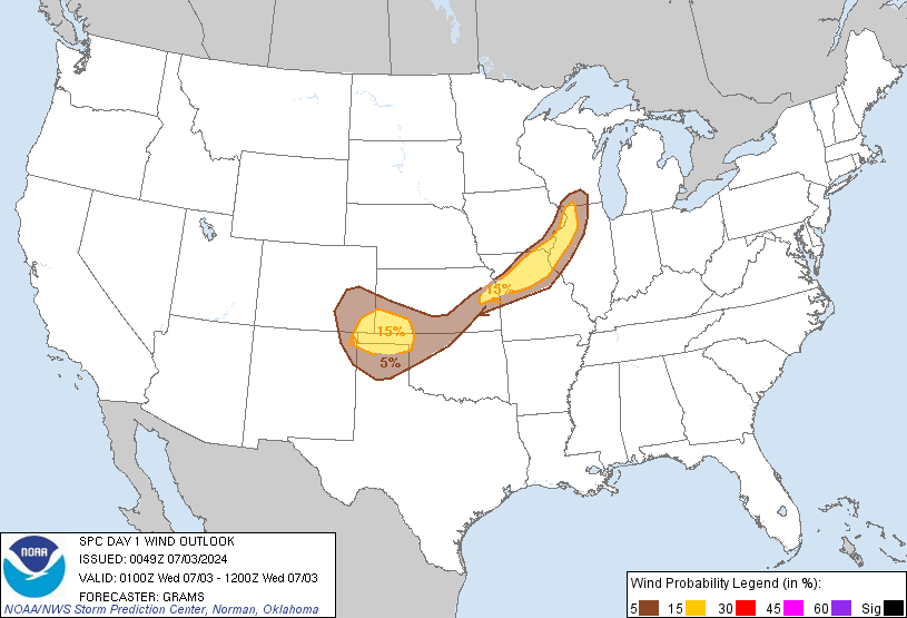
fuagf, and all in Texas -- in apparently about 5-7 hours here, a risk of severe -- current outlook maps (will update to tomorrow's outlook at 1200Z) -- we're just within the northern extent:
and this is one of those 100% it's definitely coming deals, pretty much everyone everywhere within the outlooked area is going to be affected (at least some strong if not severe wind) -- event already under way and rather conspicuously on the move (and yes, that is a strong little eastward-advancing upper level low, a shortwave aloft, quite directly/visibly driving the event):
having so far generated 8 severe thunderstorm warnings where it is and has been still well west of the outlooked area:
Severe Weather and Flash Flood Warnings College of DuPage Meteorology http://kamala.cod.edu/svr/ [click on the location of the NWS office to bring up the particular warning; click on the location's 4-letter (e.g., currently, 'KMAF') station ID to bring up a list of and view recent severe weather statements issued by that office]
Register for free to join our community of investors and share your ideas. You will also get access to streaming quotes, interactive charts, trades, portfolio, live options flow and more tools.
 News
News  Market Data
  Discover